Learn the console once, then earn each airport.
The Academy has two parts. The core course teaches what is the same everywhere: reading the scope and the strips, the radio, the commands, emergencies and how you are scored. Each airport then has its own endorsement: a unit briefing on its aerodrome, procedures, weather and local rules, and three guided exercises with a coach card on the scope. Finish all three for that airport’s badge.
03Reading the console
The scope
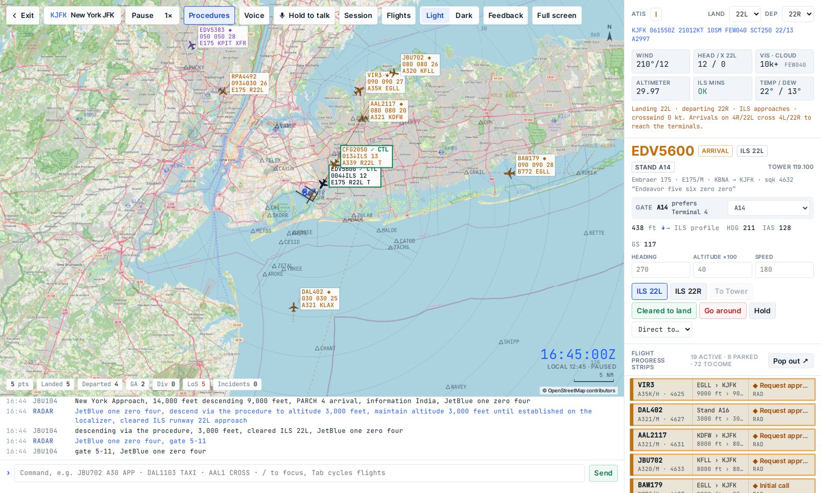
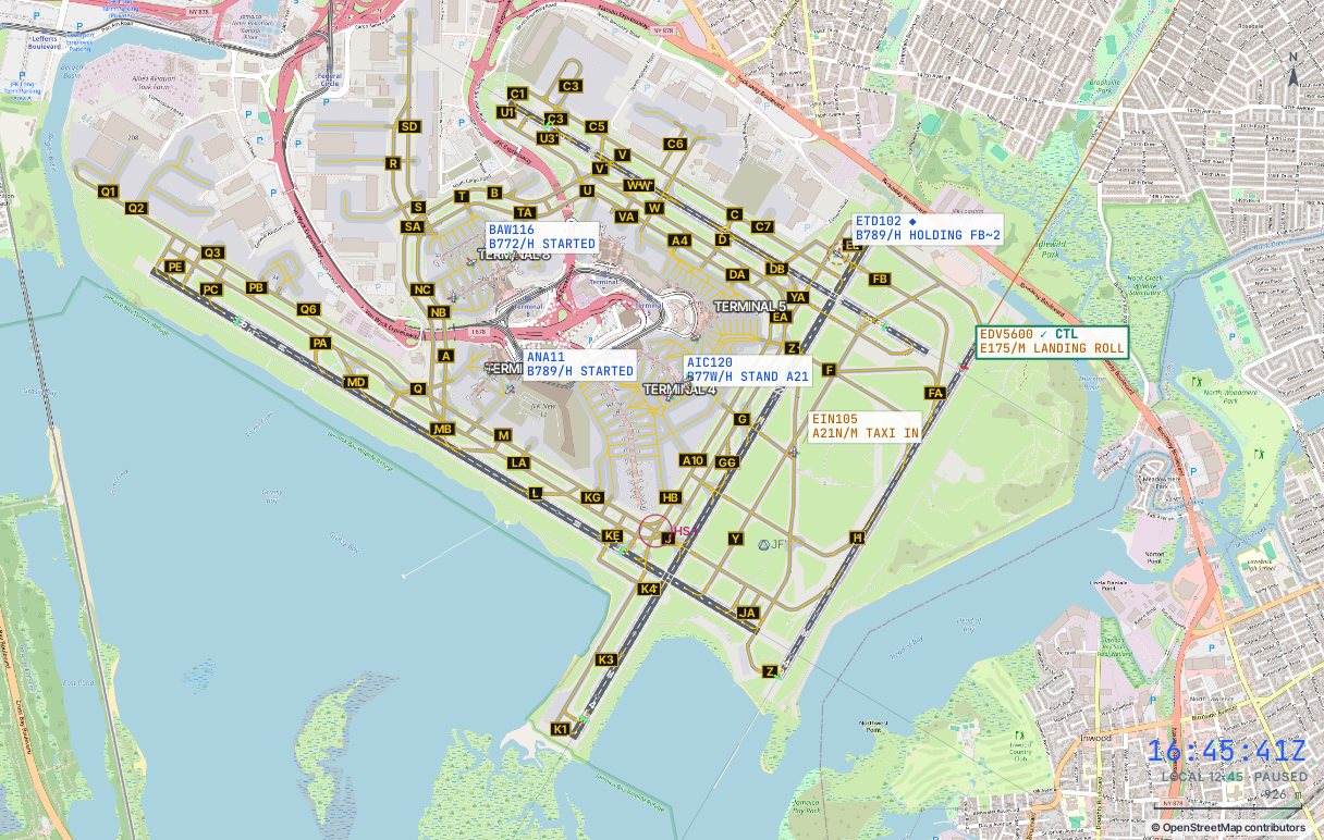
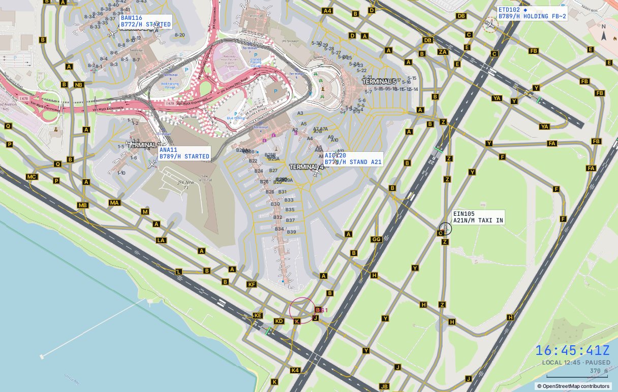
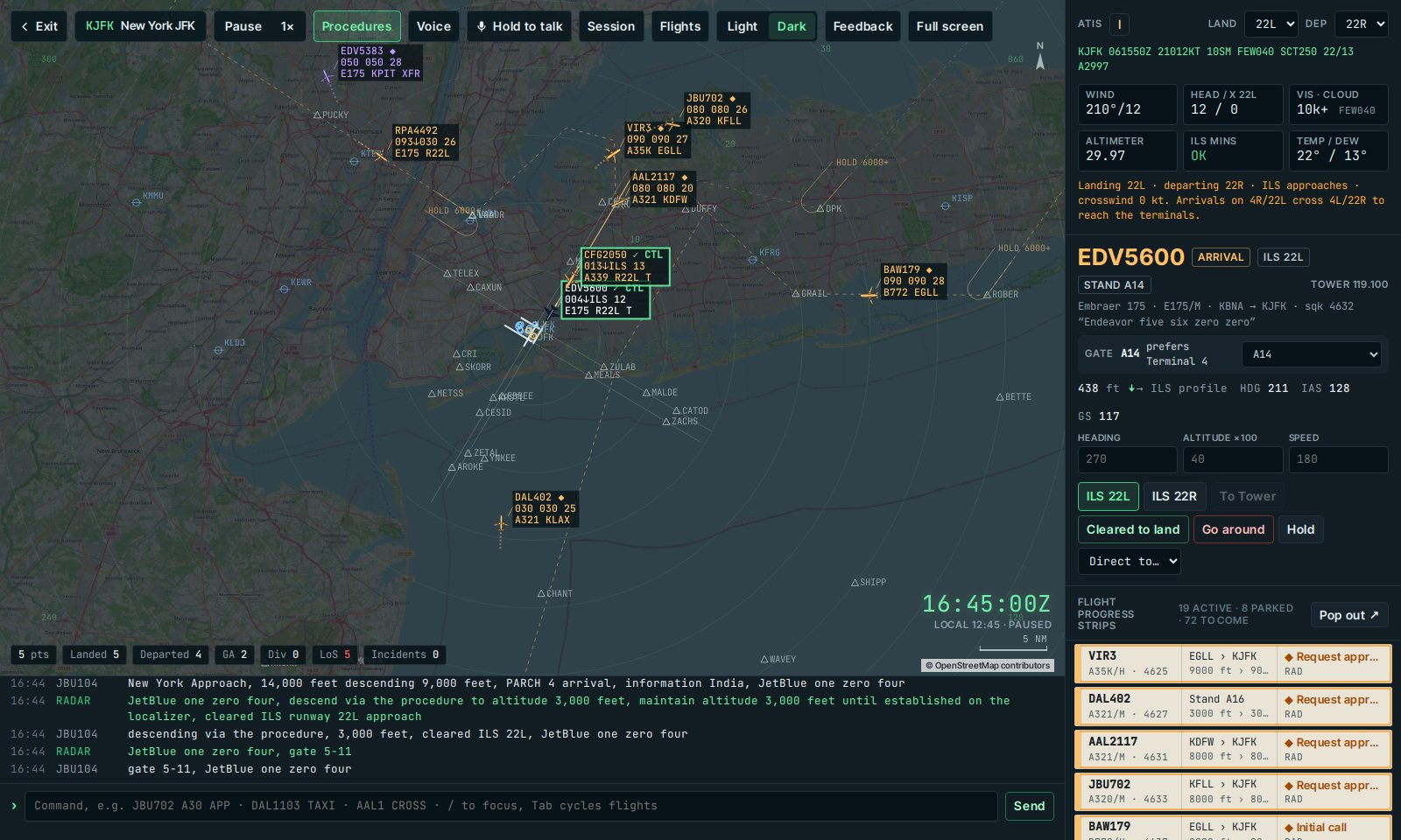
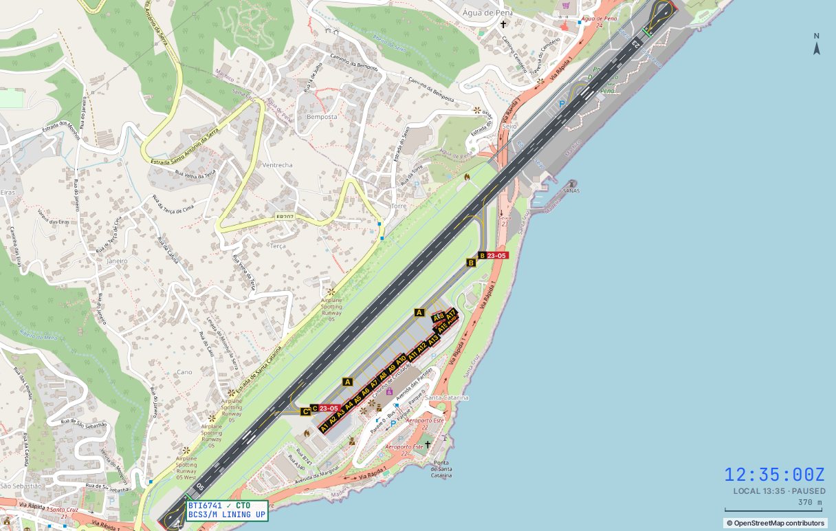
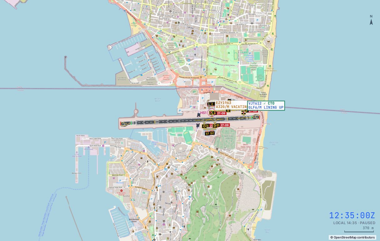
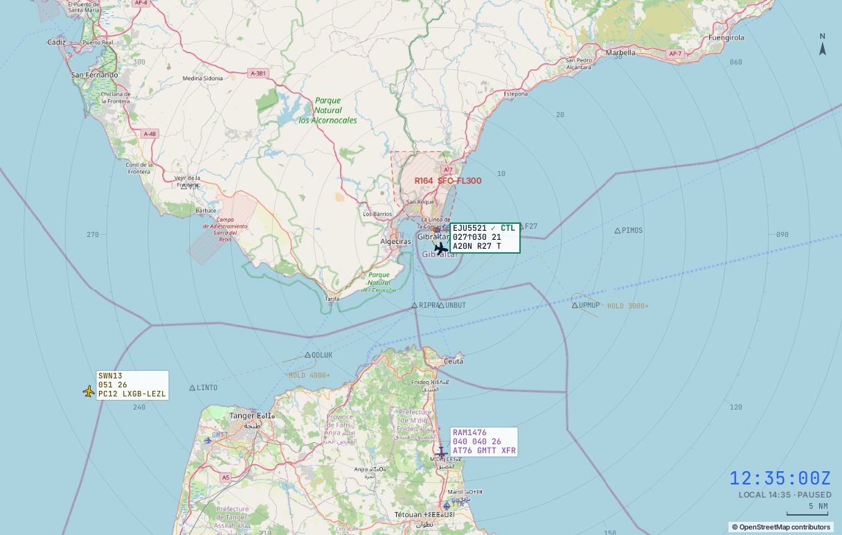
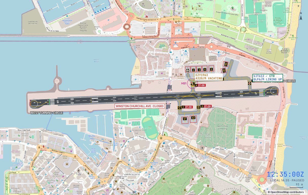
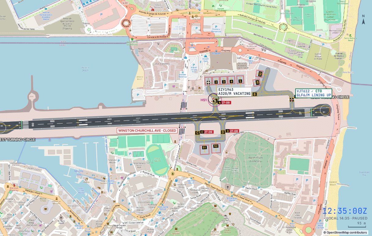
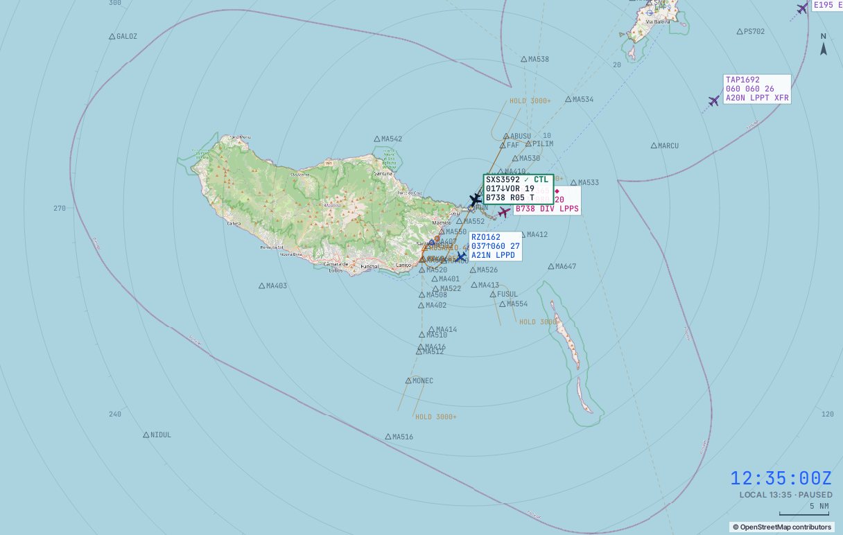
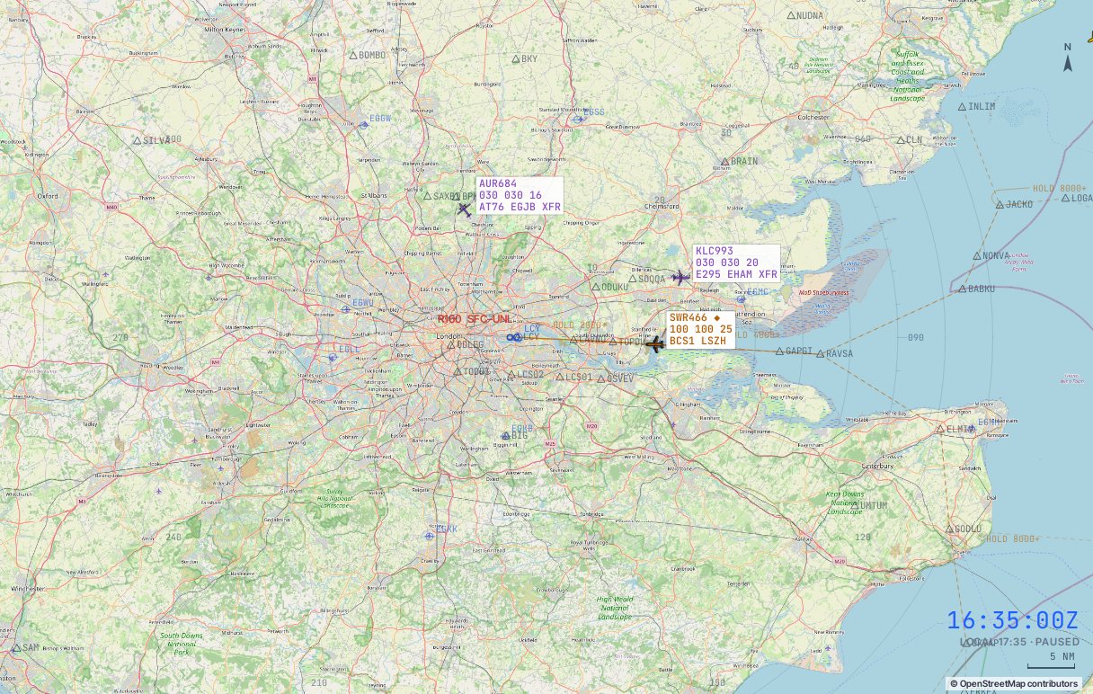
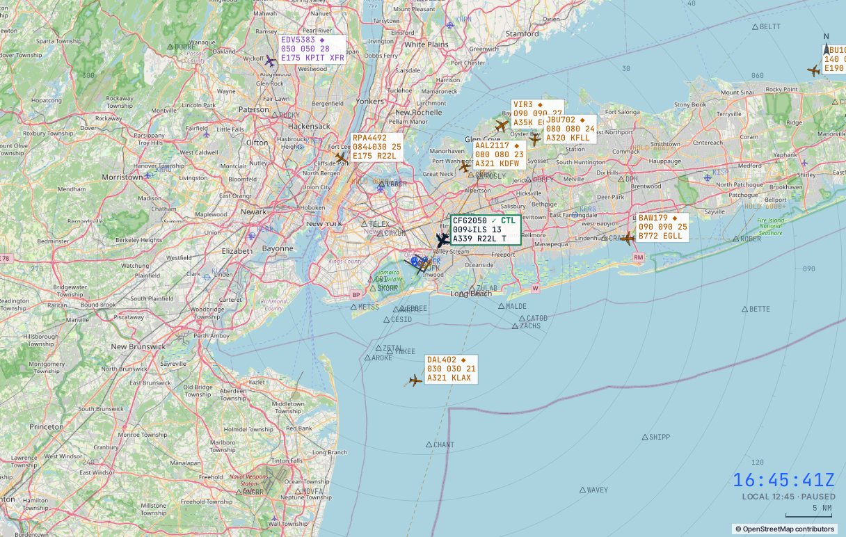
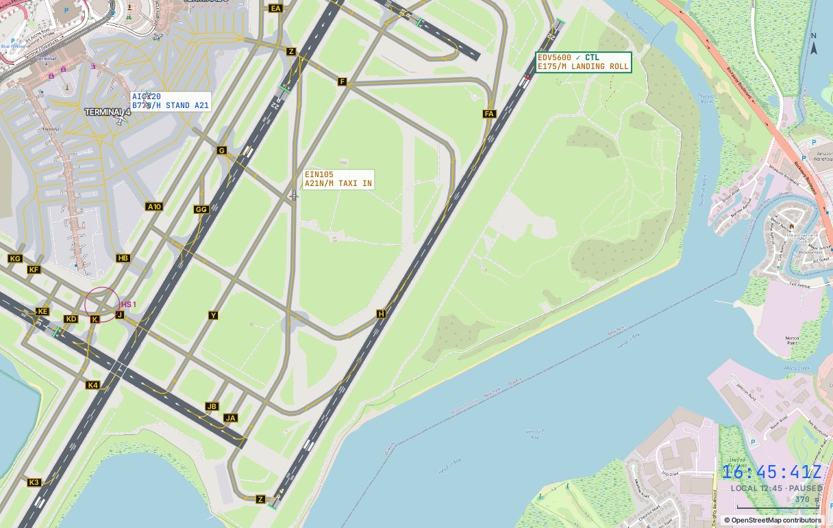
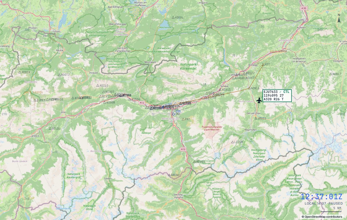
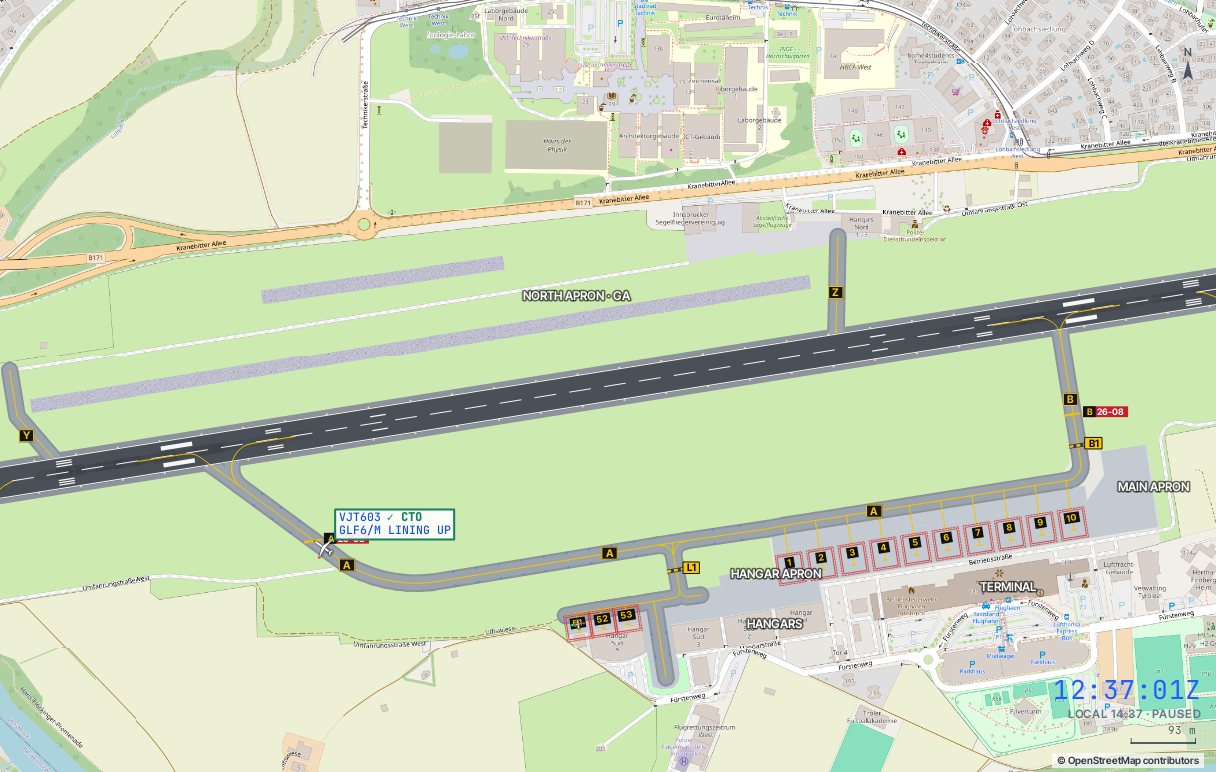
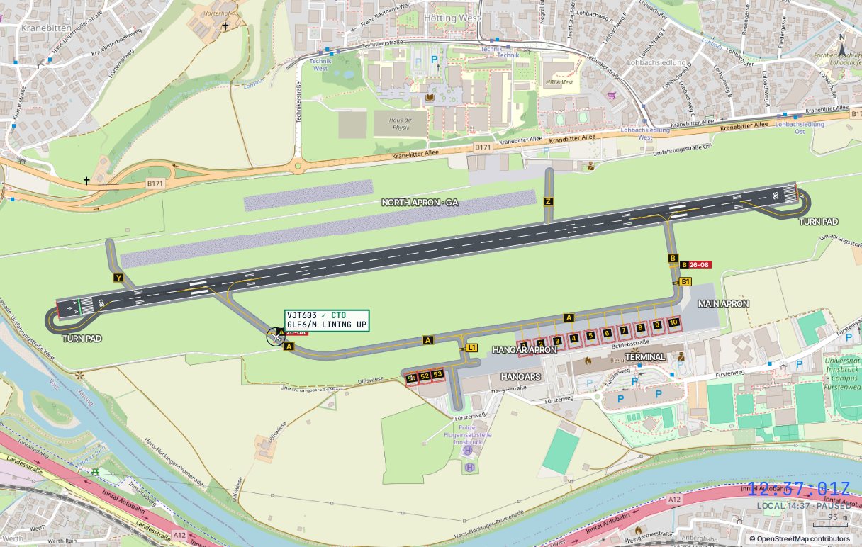
The scope is one map you scroll or pinch to zoom. Zoomed out it shows the airspace round the airport’s radar reference (the GBR TACAN at Gibraltar, the FUN DVOR at Madeira) with range rings every 5 NM, the bearing scale, restricted airspace and high ground, the arrival routes and holds, and the final approach paths. Zoom in and the runway, finals and the aerodrome appear to scale over the street map. Zoom right out to follow flights across Europe and Africa. Drag to pan.
Your traffic is drawn as plane icons in the shape of the real type (airliner, wide-body, business jet, turboprop or military) pointing the way the nose points. Arrivals are amber, departures blue and the selected flight is outlined. Once you transfer a departure to the next unit it turns purple, its strip greys out and you can no longer select it or give it instructions. Anything in conflict, and any aircraft in an emergency, turns red. Grey icons with a short tag are real aircraft from the live feed that are not yours. Beyond radar cover your flights become yellow icons, and inbounds about to call appear as pending tracks. On the ground, aircraft are drawn to scale as silhouettes, with nav lights and a beacon once started.
The side panel
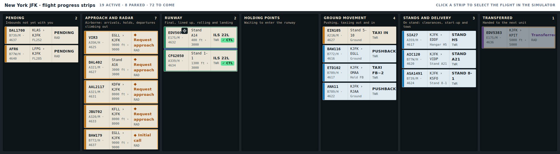
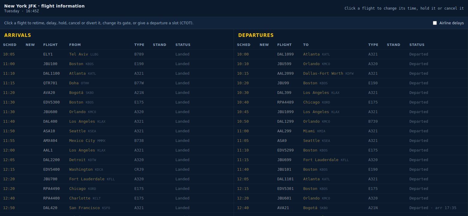
The ATIS block shows the current information letter (click it to read the full broadcast), the runway selector, the METAR and tiles for wind, head and crosswind on the runway in use, visibility and cloud, QNH, approach minima and temperature. Below it is what the airport needs on top: the road crossing control at Gibraltar, the anemometer readings and wind-limit state at Madeira. The selected flight card has the buttons that make sense for that aircraft right now. The strips are sorted with the flights waiting on you first. When the ATIS changes a red ATIS warning flashes by the runway until you click it, and the Flights button opens the day's arrivals and departures board.
The command line
Type a callsign (or just its digits, such as 8901) followed by one or more instructions, then press Enter. With a flight selected you can leave the callsign out. Press / to jump to the command line, Tab to cycle flights and Space to pause. With Voice on you hear every transmission, and Hold to talk lets you say the instruction in standard phraseology instead.
On a phone or tablet
On a narrow screen the scope sits on top and a tab bar along the bottom chooses one panel under it: Flight (the selected aircraft and its buttons), Strips (with a red count of flights waiting on you), ATIS, Radio (the message log) or Scope for the map on its own. Tap an aircraft or a strip and the Flight panel opens. On a tablet held upright Flight and Strips sit side by side, and on a phone turned on its side the panel moves to the right of the scope.
10The radio
With Voice on, every transmission opens and closes with a squelch click and a burst of static. Calls to the next unit (Sevilla or Casablanca from Gibraltar, Lisboa from Madeira) go down the landline, so they have none and show in pink in the log.
- Say again. Now and then a crew misses an instruction and asks you to repeat it. Nothing you said has been applied: press the Say again button on its card or send it again.
- Blocked transmissions. When two stations call at once you hear a squeal and see two stations transmitting at once, blocked in the log. The crew calls again a few seconds later.
- Wrong frequency. Send a crew to the wrong frequency with
HOand it comes back to you after half a minute, saying there was no reply.
The ATIS
Click the information letter in the ATIS panel to read the full broadcast, and press Broadcast it to hear it. It carries the runway, the approach in use, wind, visibility, cloud, temperature, QNH, the transition level, turbulence, windshear and wind-limit warnings, any runway closure and the local reminders, such as the road at Gibraltar and the departure release. When it changes, a red ATIS button flashes until you click it.
11Command reference
| Command | Meaning | Example |
|---|---|---|
| H### / L### / R### | Fly heading, turn left or turn right heading | EZY8901 L200 |
| A## / C## / D## | Climb or descend. Below 400 means hundreds of feet. Above the transition altitude (6,000 ft at Gibraltar, 5,000 ft at Madeira) it is a flight level | A40 · A80 |
| S### / SN | Assign speed, or remove the restriction | S180 |
| DCT fix | Proceed direct to a fix | DCT UPMUP |
| HOLD [fix] | Hold at a fix, or at present position | HOLD UPMUP |
| APP [runway] | Clear the approach: the SRA at Gibraltar, the VOR approach at Madeira | APP 27 · APP 05 |
| HO [freq] | Transfer: Radar or Approach ↔ Tower, then the next unit (Sevilla 132.6 or Casablanca 125.5 from Gibraltar, Lisboa 132.255 from Madeira). A wrong frequency sends the crew away and back | HO 132.6 |
| CTL | Cleared to land | CTL |
| GA | Go around | GA |
| PUSH [E|W] | Route clearance, start-up and push back approved, facing east or west (north-east or south-west at Madeira) | BAW493 PUSH E |
| PULL | Pushed the wrong way: the tug pulls it forward back onto its stand, nose-in, and the crew calls again for push back. Works while pushing or pushed, before taxi | BAW493 PULL |
| TAXI [hp] [VIA …] | Taxi to a holding point (A, C, D or E at Gibraltar, B or C at Madeira), by the shortest route or the one you name. Taxi… on the selected flight opens the route picker | TAXI E VIA A B |
| HP / RES | Hold position / continue taxi | HP |
| LU | Line up and backtrack | LU |
| REL | Request the departure release from the next unit on the landline | REL |
| CTO | Cleared for take-off on the departure route. Needs a valid release | CTO |
| VAC [exit] | Vacate via another exit (backtrack if needed). Arrivals vacate by themselves; this overrides their choice | VAC |
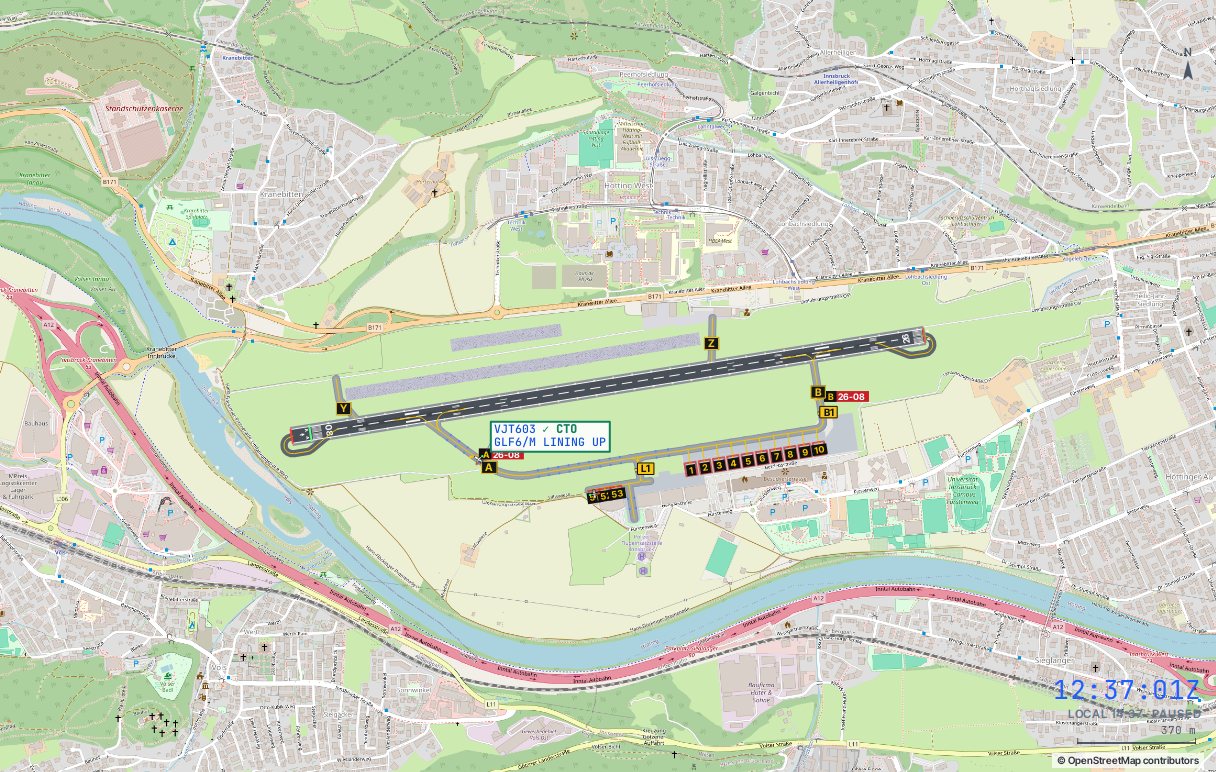
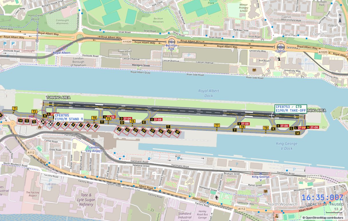
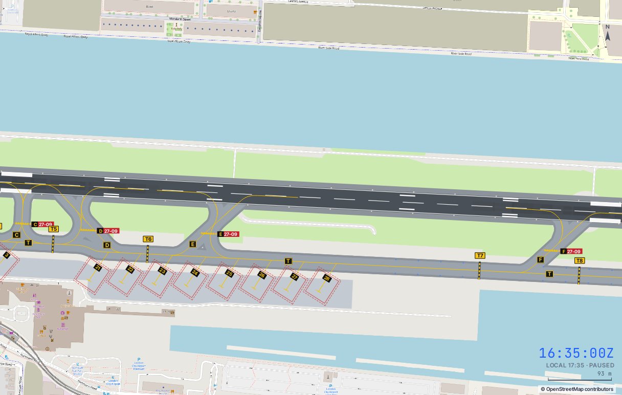
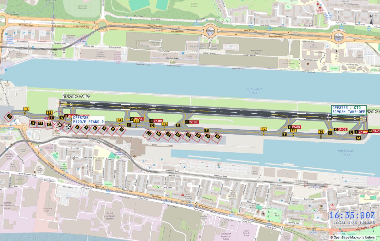
| TAXI [ihp] | Taxi to an intermediate holding point on a taxiway (Tango 1–9 at London City, Lima 1 and Bravo 1 at Innsbruck) and wait there. Arrivals can also be held at any runway holding point. TAXI on its own then carries on. The route picker lists them, and so does Taxi to holding point… for an arrival | CFE8703 TAXI T3 |
| TAXI [stand] [VIA …] | An arrival clear of the runway stops and asks for taxi: this sends it to its planned stand, or the one you name | EZY8901 TAXI 3 |
| ROG | Acknowledge a MAYDAY or PAN (any instruction to it also does) | EXS96K ROG |
| WS | Pass the latest windshear report to an arrival | BAW492 WS |
| IDENT | Squawk ident | IDENT |
Commands chain: EZY6497 L180 A40 S200 is one transmission. The callsign can be shortened to its unique digits.
09Emergencies and the unexpected
Pick how often things go wrong when you open a session: Off, Occasional (about every 20 minutes) or Frequent (about every 10). Guided exercises have none. An emergency aircraft turns red on the scope and the strips, squawks 7700 for a MAYDAY, and its card shows what is wrong with a Roger button. Your first transmission to it acknowledges it, so you can roger it and give the approach in one go.
| Event | What happens | What to do |
|---|---|---|
| MAYDAY | Engine failure or fire, smoke in the cabin, hydraulic failure. A departure turns back | Acknowledge, make it number one on the approach, keep others out of its way. The runway is inspected after it lands |
| PAN medical | An arrival has a sick passenger and wants priority and an ambulance | Acknowledge and sequence it first |
| Medical diversion | An overflight diverts in from the edge of your airspace | Treat it as an extra arrival with priority |
| Bird strike | A departure hits birds after take-off and returns, or an arrival reports birds on short final | Bring the returning aircraft in. The runway closes for an inspection |
| Runway closed | Debris, a tyre fragment or a fuel spill, for four to seven minutes | Cancel landing clearances (GA or HOLD) and hold departures until it reopens |
| Person on the runway (Gibraltar) | Someone climbs the barrier at Winston Churchill Avenue while an arrival is on final | Send it around straight away with GA. Leave it to the crew and they go around anyway, but late |
| Windshear report | In strong or gusty winds a crew reports a loss of airspeed on final. It goes into the ATIS | Pass it to every arrival on approach with WS. Briefed crews cope better |
12Scoring and your career
| Event | Points |
|---|---|
| Landing | +25 |
| Take-off · departure transferred and gone | +10 · +20 |
| Road still open at 10 NM (Gibraltar) | −15 |
| Departure leaves without a transfer | −30 |
| R164 infringement (Gibraltar) · unplanned diversion | −40 |
| Below the minimum at an approach gate (920 ft at Gibraltar’s 3 NM point; GELO and Rosário at Madeira) | −40 |
| Loss of separation | −50 |
| Movement across the road with barriers up, or landing with the road open (Gibraltar) | −60 |
| Over high ground below its minimum: the Rock below 3,000 ft (1,800 ft), Madeira’s interior below 5,000 ft (3,000 ft) | −30 (−80) |
| Emergency acknowledged in time · landed safely | +10 · +40 |
| Arrival sent around for a person on the runway · windshear passed | +20 · +5 |
| Emergency not acknowledged within a minute · crew sent to a wrong frequency | −10 · −10 |
| Crew had to go around on its own for a person on the runway | −25 |
| Arrival still cleared to land on a closed runway | −30 |
Every session you work for more than a minute goes into your Career logbook: time on frequency, movements, go-arounds, separation losses and score, with a chart of your recent scores and badges to earn, from First contact to Ten hours. One logbook covers every airport, and each airport adds badges of its own, such as Madeira’s Rosário turn and Island endorsement. The logbook is kept in your browser, so it stays on this device.
01Your position at Gibraltar
You are Gibraltar Radar (122.8) and Gibraltar Tower (131.2) combined. Ground movement is handled on the Tower frequency. Arrivals call Radar at about 50 NM inbound. You hand them to Tower once they are established on the approach, or you clear them to land yourself. Departures start with Tower, go to Radar once airborne, and you transfer them to Sevilla Control 132.6 (north and west) or Casablanca Control 125.5 (south) beyond about 22 NM.
A session starts at the day and hour you pick and runs to the end of that day's timetable. The guided exercises start at 1855Z (2055 local). The aerodrome is drawn with its edge lights, threshold and end lights, blue taxiway edge lights, flashing runway guard lights and floodlit apron.
The real unit splits Radar and Tower across separate controllers. Here they are one seat, so every handover between them is a button press that you make to yourself.
02The aerodrome
| Item | Value | Source |
|---|---|---|
| Runway | 09/27, 1,798 × 45 m, true bearing 087.5°/267.5°, blacktop | AD 2.12 |
| Thresholds | THR 09 138 m and THR 27 132 m in from the runway ends. LDA 1,528 m on both runways | AD 2.13 |
| Take-off run | TORA 1,666 m (09) and 1,662 m (27), from the runway end to the opposite threshold lights | AD 2.13 |
| Taxiways | A, B, C, D and E, all 19 m wide with solid yellow edge lines and blue edge lights | AD 2.8–2.9 |
| Guard lights | Runway guard lights at holding points A, C, D and E only | AD 2.9 |
| Unserviceable | Twy B east of E and the B1 link are marked × on D1/E1. The simulator keeps them closed | D1, E1 |
| Aprons | Civil apron with stands 1–5 (nose-in, push back). North apron for business jets. South apron for RAF movements | AD 2.8, F1 |
| Hot spot | HS1 at the junction of A and B, beside holding point A | D1, E1 |
| Turnaround | All aircraft above 17,000 kg MCTOM must use the turning circles before backtracking. No turning on the runway | SP (2) §10 |
Holding points and where they lead
Alpha (north side, west of the terminal) and Echo (north side, east) serve the civil and north aprons. Charlie and Delta serve the south apron. Every entry to the runway is mid-field, so every departure backtracks. Runway 27 departures normally enter at Echo and backtrack east to the east turning circle. Runway 09 departures enter at Alpha and backtrack west across the road to the west turning circle.
04Ground and departures
Start-up and push
Departures call from the stand with the ATIS letter. Select the flight and press Start & push…: a pop-out asks which way the nose should face after the push, previews the push on the map and recommends the side that leads to the departure holding point (east for runway 27, west for 09). Typed, it is PUSH E or PUSH W. A few seconds after the push the crew reports ready to taxi. Pushed it the wrong way? Press Pull back to stand (or type PULL, or say “pull forward onto stand”) before you clear it to taxi: the tug tows it back onto the stand nose-in and the crew asks for push back again.
Taxi
| From | Runway | Holding point | Clearance | Command |
|---|---|---|---|---|
| Civil apron 1–5 | 27 | Echo | “taxi to holding point Echo via Bravo” | TAXI E |
| Civil apron 1–5 | 09 | Alpha | “taxi to holding point Alpha” | TAXI A |
| North apron N1–N2 | 27 | Echo | “taxi to holding point Echo via Bravo” | TAXI E |
| North apron N1–N2 | 09 | Alpha | “taxi to holding point Alpha via Bravo” | TAXI A |
| South apron S1–S2 | 27 | Delta | “taxi to holding point Delta” | TAXI D |
| South apron S1–S2 | 09 | Charlie | “taxi to holding point Charlie” | TAXI C |
Press Taxi… to open the route picker. It lists each holding point the aircraft can reach with up to three routings, such as Echo via Bravo or Echo via Alpha and Bravo, with their lengths. Hover over one to see it drawn on the map, then click to issue the clearance. The clearance names the taxiways. Aircraft give way to each other: one that stops behind another shows GIVING WAY in its label. Stop one yourself with HP (hold position) and release it with RES (continue taxi). Re-clear a taxiing aircraft to a different holding point with TAXI A and the rest. Where the chart publishes intermediate holding points along a taxiway (the yellow dashed lines with a sign, such as Tango 3 at London City), TAXI T3 stops the aircraft there until you clear it on.
Holding point Alpha sits right at the junction of A and B. An aircraft holding at A blocks traffic along B to and from the civil apron, so sequence the outbound and inbound flows before you clear anyone onto A.
Departure routes and the release
Every departure flies a named standard route, given with the start-up: PIMOS 1A or 1B to the east, LINTO 1A/1B to the west and TTN 1A/1B to Morocco. The A routes are for runway 27 (left turn heading 200), the B routes for runway 09 (straight ahead to 1,500 ft, then right heading 160). Both turns keep departures clear of R164 to the north and the Rock to the south. Once clear of the Rock the aircraft routes on to UPMUP and PIMOS, ODLUK and LINTO, or TTN by itself, climbing to 4,000 ft.
Gibraltar sits under Spanish airspace, so no departure goes without a release from the next unit: Sevilla for the east and west routes, Casablanca for TTN. Press Request release or type REL any time after start-up. The call goes down the landline (shown in pink in the log) and the unit calls back within a couple of minutes: usually “released, valid until” a time ten minutes away, sometimes “not before” a time a few minutes ahead. The strip shows REL… while you wait and REL once released. CTO is refused without a valid release. If the window runs out before take-off, ask again.
The AIP publishes no SIDs for Gibraltar. These route names and headings are the simulator's stand-in for the departure clearances Gibraltar and Sevilla agree.
Line up and take-off
LU lines an aircraft up and backtracks it to the turning circle. CTO clears it for take-off. Issued at the holding point, CTO lines it up, backtracks, turns and rolls in one go. The departure route is confirmed with the clearance:
If the runway changed since start-up, Tower gives the amended route. The departure minimum is 1,000 m visibility at the threshold.
After take-off
Above 1,000 ft the crew wants Radar: press To Radar 122.8 (HO). On its route it turns towards its exit fix by itself and asks for further climb near 4,000 ft: give it A80. Vector it with a heading and it leaves the route, then asks for its exit fix when clear of the Rock (DCT UPMUP A80). Beyond about 22 NM it is ready for Sevilla Control 132.6 or Casablanca Control 125.5. Transfer it with HO, or name the frequency yourself with HO 132.6. Give the wrong one and the crew finds nobody there and comes back to you a little later, which costs points. One that leaves your airspace without a transfer costs more.
05Winston Churchill Avenue
Gibraltar's runway is crossed at mid-point by a four-lane public road, footpath and cycle lane. The published rule is to close it to pedestrians by 15 NM and to vehicles by 10 NM, which gives about three minutes to clear it. A FOD inspection follows before any jet movement.
- Closing takes 150 seconds in the simulator. The barriers turn amber, then red when it is closed.
- You are warned when an arrival passes 15 NM with the road open, and penalised if it is still open at 10 NM.
- Landing with the road open forces a go-around and counts as an incident. So does a take-off, backtrack or vacate across the road with the barriers up.
- The road cannot be reopened while anything is on the runway. Reopening takes 15 seconds. A queue of traffic and walkers builds while it is shut, so do not leave it closed longer than you need.
A runway 09 departure backtracks across the road to the west turning circle, and a runway 27 arrival usually rolls past it and backtracks over it to vacate at Alpha. Close the road once for a whole sequence of movements, not once per aircraft.
06Arrivals and the SRA
Inbound
Arrivals contact Radar at 50 NM from the east via PIMOS, from the west via LINTO and ODLUK, or from Morocco via Tetouan. Descend them early: Gibraltar is close to everything. The published holds are UPMUP (inbound 297°, minimum 3,000 ft) and ODLUK (inbound 074°, minimum 4,000 ft). About 8 NM before the end of its routing (10 NM final for 27, RIPRA for 09) the crew asks for the SRA. Without a clearance it holds over that fix and asks again. Clear it with APP and it turns straight onto the approach.
The surveillance radar approach
There is no ILS. Approaches are SRAs to a visual landing: Radar talks the aircraft down a 2.8° profile to a point 3 NM from the threshold, where the crew must be visual.
| Runway 27 | Runway 09 | |
|---|---|---|
| Join | Vectors or own navigation to a 10 NM final on 267° | RIPRA (GBR 9 DME), then track 359° |
| 3 NM point | Point Yankee, straight in | Point X-Ray, then a descending right turn onto 087° |
| Minima | Visibility 5 km (or 5 km along the approach path) and cloud base 1,000 ft. Not visual at the 3 NM point: missed approach as directed by ATC | |
| Missed approach | Climb to 4,000 ft QNH as directed by Radar. The simulator turns them south: left for 27, right for 09 | |
| Comms failure | Lost contact for more than 10 seconds on the SRA: climb immediately to 4,000 ft QNH, then route own navigation to PIMOS | |
Clear the approach with APP 27 or APP 09. If the aircraft's heading will intercept the final it follows your vectors, and otherwise it routes itself to the 10 NM point or to RIPRA. Hand it to Tower with HO and clear it to land with CTL once the road is shut and the runway is free.
Separation
Keep 3 NM or 1,000 ft between airborne aircraft, reduced to 2.5 NM when both are established on final. Holding at UPMUP stacks traffic 1,000 ft apart. A loss of separation costs 50 points and turns both targets red.
After landing
Landings on 27 usually roll well past the mid-field taxiways and stop near the west end. VAC sends the aircraft on to the turning circle and back along the runway (across the road) to Alpha, where it stops clear of the runway and asks for taxi (TAXI). Landings on 09 can usually turn off at Echo. Name an exit with VAC A or VAC E.
07Weather
When the wind is between 110° and 250°, the Rock sits upwind of the approach, and above these speeds turbulence and windshear are likely on final:
- Levanter (easterly): runway 09 is in use. The approach comes up from the south through RIPRA and turns in over the bay, into the curl coming off the Rock. Expect go-arounds.
- Poniente (south-westerly): above 25 kt, waterspouts can form on the runway 27 approach. They develop quickly and without warning.
- Sea fog: below 5 km or 1,000 ft the SRA cannot be flown. Crews refuse the approach, hold briefly, then ask to divert to Málaga or Tangier. Approve it with the Approve diversion button.
- Thunderstorms: cumulonimbus adds a windshear risk on every approach.
Crews refuse an approach and go around when the crosswind including gusts is above 33 kt (22 kt for light aircraft) or the tailwind is above 10 kt. After a second weather go-around they divert. These are the simulator's typical airline limits, not published LXGB figures.
08Airspace and terrain
R164 is Spanish restricted airspace from the surface to FL300, beginning at the frontier fence just north of the runway. Any aircraft below FL300 inside it is an infringement. Runway 27 departures turn left onto 200° to stay out, and missed approaches turn south.
The Rock rises to 1,398 ft immediately south of the aerodrome. Overflight is prohibited, and below 3,000 ft it is penalised as a terrain hazard. When you give a departure a direct routing below 3,500 ft, you get a warning if the track crosses the Rock.
Helicopter routes in the Bay of Gibraltar conflict with the 09 approach and the 27 departure. They are not simulated, but they are one more reason the published procedures keep traffic tight to the runway.
13Guided exercises
Each exercise opens the simulator with a small traffic load and a coach card on the scope. The card tells you what the crew wants, which button or command does it, and moves on when you have done it. Complete all three for the Academy graduate badge.
One A320neo on stand 3, fair weather, runway 27. Push with its PIMOS 1A route, taxi via Bravo to Echo, get Sevilla's release, close the road, backtrack and take off, then hand it to Sevilla on 132.6.
One arrival from the east. Descend it, clear the SRA for runway 27, close the road in time, land it, and backtrack it to Alpha and the stand.
An easterly gale. The arrival joins via RIPRA and Point X-Ray in the lee of the Rock while an ATR departs from the south apron via Charlie, released by Casablanca.
14What is simplified at Gibraltar
- Radar and Tower are one position, and Ground is worked on the Tower frequency.
- The timetable is a representative week, and routes between airports are approximate. Live now uses today’s real flights and positions, but once a flight is yours it follows your instructions rather than its real track.
- The R164 northern boundary and the outline of the Rock are approximations. The aerodrome layout follows OpenStreetMap, checked against chart D1.
- The departure route names, post-departure headings, release times and crew wind limits are modelled, not published.
- Emergencies follow a simple script: the crew declares, you acknowledge and give priority, and it lands. Fire service, ambulance and inspections are reported in the log rather than drawn.
- Helicopter traffic, the arresting gear and lamp signals are not simulated.
01Your position at London City
You are Thames Director (132.700) and City Tower (118.080) combined, with ground movement on the Tower frequency. Arrivals call Thames off their STAR, heading for the JACKO hold over Essex or the GODLU hold over Kent. You hand them to the Tower once they are on the ILS. Departures start with the Tower, go to Thames once airborne, and you transfer them to London Control when they ask for more than 3,000 ft. The ATIS is City Information on 136.355.
The transition altitude is 6,000 ft. London City sits under the London TMA, with Heathrow's traffic to the west, Stansted's to the north and Gatwick's to the south: that is why every SID stops at 3,000 ft and every arrival is fed in low along the river.
City Tower has no tower. Since 2021 the controllers have sat at the NATS centre in Swanwick, Hampshire, 80 miles away, watching a wall of screens fed by cameras on a 50 m mast beside the King George V Dock.
02The aerodrome
| Item | Value | Source |
|---|---|---|
| Runway | 09/27, 1,508 m × 30 m, grooved asphalt, magnetic 091°/271°. Arrestor beds beyond both ends | 2-1 |
| Thresholds | THR 09 at 19 ft, THR 27 at 20 ft, at the runway ends. PAPI 5.5° on both | 2-1 |
| Taxiways | T, parallel to the runway on the south side. Links A, B, C, D, E, F, K, L and M join it to the runway | 2-1 |
| Stands | Main apron 3–10, west apron 12–14, GA apron 15, east apron 21–28. All nose-in, pushed back onto T | 2-2 |
| Hot spot | HS1 at Alpha and T2: the GA apron, stand 10 and the holding point sit close together | 2-1 |
Where departures go
Runway 27 departures taxi east along T to Mike; runway 09 departures west to Alpha. Both join the runway at its end, so there is no backtrack. Lima, Kilo, Bravo and Charlie are intersections: a departure from one of them backtracks to the turning area first. Arrivals take the first exit ahead of them: Echo, Delta or Charlie rolling west on 27, Foxtrot, Kilo, Lima or Mike rolling east on 09.
03Ground and departures
| Runway | Holding point | Push | Command |
|---|---|---|---|
| 27 | Mike (full length) | Facing east | PUSH · TAXI M |
| 09 | Alpha (full length) | Facing west | PUSH W · TAXI A |
SIDs
Four RNAV SIDs, named for their exit fix: BPK for Scotland and the north, SAXBI for Ireland, the west and the Channel Islands, SOQQA for the Netherlands and Scandinavia, and ODUKU for France, Germany, Switzerland, Italy and Iberia. Off runway 27 they are the 1A routes, off 09 the 1H. All climb straight ahead first, with no turn below 1,102 ft off 27 or 570 ft off 09, and all stop at 3,000 ft.
The release from London Control
Every departure needs a release from London Control on the landline before take-off. Press Request release or type REL once it is taxiing. The release is valid for about ten minutes, and CTO is refused without one. Once airborne, hand it to Thames with HO; when it asks for more, climb it and transfer it to London Control with HO again.
04Arrivals and the steep ILS
STARs, holds and transitions
London Control brings arrivals down their RNAV STARs to JACKO (FL090, from the north, west and east) or GODLU (FL100, from the south and south-west). From the hold, Thames takes them along a transition: LAVNO 1J/1G west up the estuary to the runway 27 localiser at 3,000 ft, or ODLEG 1J/1G round the south of the city to the runway 09 localiser at 2,000 ft. You can shorten either with a direct-to, or vector off it.
The 5.5° ILS
Clear the approach with APP. The glidepath is 5.5°, nearly twice the usual 3°: about 585 ft per mile, or 1,200 ft a minute at City approach speeds. Only aircraft certified for steep approaches come here: the Embraer 190 and 195-E2, the A220-100, the Dash 8-400, the ATR and a handful of business jets.
| Runway 27 | Runway 09 | |
|---|---|---|
| Transition | LAVNO 1J/1G up the estuary | ODLEG 1J/1G round the south |
| Glidepath | 5.5° from 3,000 ft, about 5 NM out | 5.5° from 2,000 ft, about 3.4 NM out |
| Approach ban | 1,000 m visibility and a 300 ft cloud base, checked at four miles | |
| Missed approach | Straight ahead to 2,000 ft, at 5.6 DME turn back (27 right, 09 left) to the LCY NDB and hold | |
Hand the arrival to the Tower with HO and clear it to land with CTL before four miles. At four miles the crew calls the Tower and checks the weather; below the approach ban, they go around.
05Airspace and obstacles
London City is inside the London CTR, under the TMA. Central London's restricted areas R157 to R160 begin a few miles west. The runway 09 final crosses R160, which is fine on the published procedures under your clearance; vectoring an aircraft through it below 3,000 ft, off the procedures, counts as an infringement.
The towers of Canary Wharf rise to 771 ft about 2.4 NM west of the runway. Any aircraft over them below 1,200 ft is an obstacle incident, and below 900 ft a serious one.
London City closes from 12:30 on Saturday to 12:30 on Sunday local time, and overnight from 22:30. The timetable respects those hours, so a Saturday evening session is quiet.
06Guided exercises
Each exercise opens the simulator with a small traffic load and a coach card on the scope. Complete all three for the Docklands endorsement badge.
A BA CityFlyer Embraer 190 on stand 5 for Edinburgh, runway 27. Push with its BPK 1A SID, taxi to Mike, get London's release, take off, and hand it to Thames and then London Control.
A KLM Cityhopper 195-E2 from Amsterdam via JACKO. Clear the ILS 27 from the LAVNO transition, watch it come down the 5.5° glidepath, land it and taxi it in.
Runway 09 in use. Get a departure away from Alpha, then bring a Swiss A220 round the south of London on the ODLEG transition, past Canary Wharf to land.
07What is simplified at London City
- Thames Director and City Tower are one position, and Ground is worked on the Tower frequency.
- London Control frequencies are representative, and the release times are modelled.
- The SID coding page was not in the chart set, so SIDs follow the tracks drawn on the SID charts.
- Every crew is approved for the steep approach, and the four-mile check stands in for the real decision altitude, which is much closer in.
- The timetable is a representative summer week. Live now uses today's real flights and positions.
01Your position at Madeira
You are Madeira Approach (119.605) and Madeira Tower (124.660) combined, with ground movement on the Tower frequency. Arrivals call Approach on their STAR, inbound to the PILIM hold. You hand them to Tower once they are on the approach. Departures start with Tower, go to Approach once airborne, and you transfer them to Lisboa Control 132.255 once they are established on their SID. The ATIS is Madeira Information on 130.355.
The transition altitude is 5,000 ft, so levels above it are flight levels. The minimum sector altitude is 3,500 ft over the sea to the east and 8,200 ft everywhere else, because of the island.
The real unit has separate Approach and Tower controllers. Here they are one seat, so every handover between them is a button press that you make to yourself.
02The aerodrome
| Item | Value | Source |
|---|---|---|
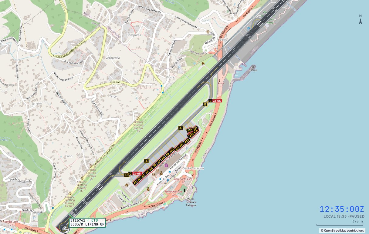
| Runway | 05/23, 2,781 m of pavement × 45 m, magnetic 049°/229°. LDA 2,481 m on both runways | AD 2.12–2.13 |
| Thresholds | THR 05 at 146 ft, THR 23 at 191 ft. PAPI 3° on both. The 05 PAPI is slewed 5° towards the sea | AD 2.24.01 |
| Turn pads | At both runway ends, the larger at the 23 end | AD 2.24.01 |
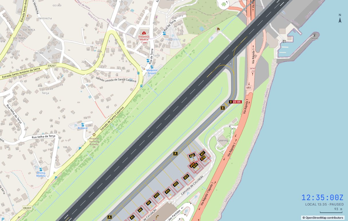
| Taxiways | Bravo (north-east) and Charlie (south-west) join the runway to taxilane Alpha. No parallel taxiway | AD 2.24.01 |
| Apron | Apron A, stands A1–A18, nose-in with push back onto taxilane Alpha. A18 takes a wide-body and closes A14–A17 | AD 2.24.02 |
Where departures go
Runway 05 departures taxi to Charlie and backtrack to the 05 turn pad. Runway 23 departures taxi to Bravo and backtrack to the 23 pad. Arrivals vacate at whichever of the two they reach, backtracking if they stop past it.
03Ground and departures
| Runway | Holding point | Push | Command |
|---|---|---|---|
| 05 | Charlie | Facing south-west | PUSH · TAXI C |
| 23 | Bravo | Facing north-east | PUSH · TAXI B |
SIDs
Every departure flies an RNAV SID named for its exit fix: DEGUN for mainland Portugal, Spain and central Europe, LAPPA for the UK, Ireland and northern Europe, GALOZ for the Azores and North America, GOSGA for the Canaries and Africa, and MARCU for Porto Santo. Off runway 05 they are the 1E routes: start a right turn as soon as practicable onto 087°, away from the high ground. Off 23 they are the 1W routes: left onto 175°, and the DEGUN, LAPPA and MARCU 1W cross 4,000 ft before turning back north.
The release from Lisboa
Madeira sits inside the Lisboa FIR, and every departure needs a release from Lisboa Control on the landline. Press Request release or type REL once the aircraft is taxiing. The release is usually valid for about ten minutes. CTO is refused without one.
Take-off wind limits
Crews will not take off with a wind from 300°–010° above 20 kt, or from 020°–040° or 120°–190° above 25 kt. They wait at the holding point and tell you why. Once airborne, hand them to Approach with HO, climb them when they ask, and transfer them to Lisboa with HO 132.255.
04Arrivals and the VOR approach
STARs and holding
Arrivals fly the LIDRO 1P from Portugal and Spain, KICAS 1P from the UK and the north, IBBAN 1P from the Azores and America and EKNOT 1P from the Canaries, all to PILIM at 3,000 ft or above. PILIM is the published hold, and it is where they wait when the wind is out of limits.
VOR approach and the Rosário circuit to runway 05
Clear the approach with APP (or APP 05). The aircraft routes via ABUSU onto the FUN 211° radial, descends to the missed approach point at 3.6 DME, then flies the visual circuit: a right turn round the GELO point, not below 850 ft, and the Rosário point, not below 460 ft, onto a short final over the sea. The circling minima are an MDA of 940 ft, 5 km visibility and an 800 ft ceiling.
VOR approach to runway 23
The same approach via ABUSU, then a visual track of 235° to the runway, staying left of the extended centreline. The minima are higher: MDA 1,300 ft, 7 km and a 1,200 ft ceiling.
| Runway 05 | Runway 23 | |
|---|---|---|
| Approach | DVOR/DME via ABUSU, final 211° to MAPt 3.6 DME FUN | DVOR/DME via ABUSU, final 211° to MAPt |
| Visual segment | Right turn past GELO (850 ft) and Rosário (460 ft) | Track 235° to the runway |
| Minima | MDA 940 ft · 5 km · ceiling 800 ft | MDA 1,300 ft · 7 km · ceiling 1,200 ft |
| Missed approach | Left onto 137° over the sea, climb to 3,000 ft | |
Hand the arrival to Tower with HO and clear it to land with CTL once the runway is free. After landing, it turns off at Bravo or Charlie (VAC and an exit picks one), stops clear of the runway and asks for taxi: TAXI sends it to its stand.
05RNP AR approaches
Madeira also has three RNP AR approaches. They are flown by the crew’s flight management system along a published path of straight legs and fixed-radius arcs, round the coast to a short final, with a vertical path all the way down. You don’t vector them: you clear them from their start fix, and the crew flies the rest. Their minima are much lower than the circling minima, so they are what gets aircraft in when the cloud is low.
| Approach | Starts at | Path | Minima (cat C, RNP 0.3) |
|---|---|---|---|
| RNP Y 05 | MONEC, south of the island | North over the sea to the FAP MA508 at 2,000 ft, then a right arc onto a 0.6 NM final | DA 910 ft (DH 764) |
| RNP Z 05 | PILIM, north-east | South-west past Caniçal, a right arc to the FAP MA522, then the same final as RNP Y | DA 910 ft (DH 764) |
| RNP 23 | PILIM, or MONEC via MA412 | To the FAP MA408 at 2,000 ft, then straight in on 229° for 5.5 NM | DA 1,200 ft (DH 1,009) |
- Clear one with
APP RNP: the aircraft takes the approach whose start fix is nearer its route. To pick one yourself, useAPP 05 RNPY,APP 05 RNPZorAPP 23 RNP, or the RNP buttons on the flight. - The aircraft descends to 3,000 ft and flies to the start fix. An aircraft that reaches MONEC from the north flies one lap of the MONEC hold to turn round before it starts the approach.
- From the start fix you watch, not vector. A heading or a direct-to takes it off the approach, and you have to clear it again.
- When the cloud is below the circling minima but above the RNP ones, the ATIS says to expect the RNP approach and crews ask for it. The weather panel shows both: VOR · RNP.
- The missed approach is published too: climb to 3,000 ft along the arcs east of the airport and back to MONEC, where the crew holds and asks for another approach.
Try it in the RNP only weather scenario: drizzle and an 800 ft cloud base, too low for the VOR approach.
06Wind limits
Madeira’s wind limits are published as a wind rose on every approach chart. They apply to the mean wind or the gust at either anemometer, MID (mid-runway) or ROSÁRIO (on the cliffs under the 05 circuit). The ATIS panel shows both readings and turns red when a limit is exceeded.
| Wind from | Runway 05 | Runway 23 |
|---|---|---|
| 300°–010° | 15 kt, gust 25 | 15 kt, gust 25 |
| 020°–040° | 20 kt, gust 30 | 20 kt, gust 30 |
| 120°–200° | 20 kt, gust 30 | 15 kt, gust 25 |
| 200°–230° | 25 kt | 25 kt |
- Out of limits, a crew refuses the approach and holds. Send it to PILIM with
HOLD PILIMand stack the next one 1,000 ft above. - After a couple of minutes in the hold the crew asks to divert, usually to Porto Santo via MARCU. Approve it with Approve diversion.
- A tailwind above 10 kt also stops a landing, so change the runway when the wind swings round.
Days with dozens of diversions to Porto Santo, Lisbon or the Canaries are not unusual in winter. Holding until the wind drops, then landing the stack in a short window, is the Madeira controller’s signature job.
07Airspace and terrain
TMA Madeira is roughly a 60 NM circle round Porto Santo, with the entry and exit fixes on its edge. Radar vectoring is done from the Porto Santo antenna. The minimum vectoring altitude is 3,000 ft over the sea and 9,000 ft over the island. In the simulator, any aircraft over the island’s high ground below 5,000 ft is a terrain incident, and below 3,000 ft a serious one.
There is no restricted area next to the field, but the island itself does the same job: departures turn out to sea, and missed approaches turn left onto 137° away from the cliffs.
08Guided exercises
Each exercise opens the simulator with a small traffic load and a coach card on the scope. Complete all three for the Island endorsement badge.
An A321 on stand A7 for Lisbon, trade wind, runway 05. Push with its DEGUN 1E SID, taxi to Charlie, get Lisboa’s release, backtrack, take off and turn right, then hand it to Lisboa.
An A320neo from Gatwick. Clear the VOR approach for runway 05, watch it round GELO and Rosário onto the short final, land it and taxi it in.
A strong northerly is over the limit at Rosário. Two arrivals call: offer the approach, hold them at PILIM 1,000 ft apart, and approve their diversions to Porto Santo.
09What is simplified at Madeira
- Approach and Tower are one position, and Ground is worked on the Tower frequency.
- The RNP AR approaches are flown at RNP 0.3 by every crew. Real operators need a special approval for them, and some fly lower RNP 0.1 minima.
- The MID and Rosário anemometer readings are derived from the METAR wind rather than measured separately.
- SIDs are flown as headings to the turn and then direct to the exit fix, and the release times are modelled.
- The timetable is a representative week. Live now uses today’s real flights and positions.